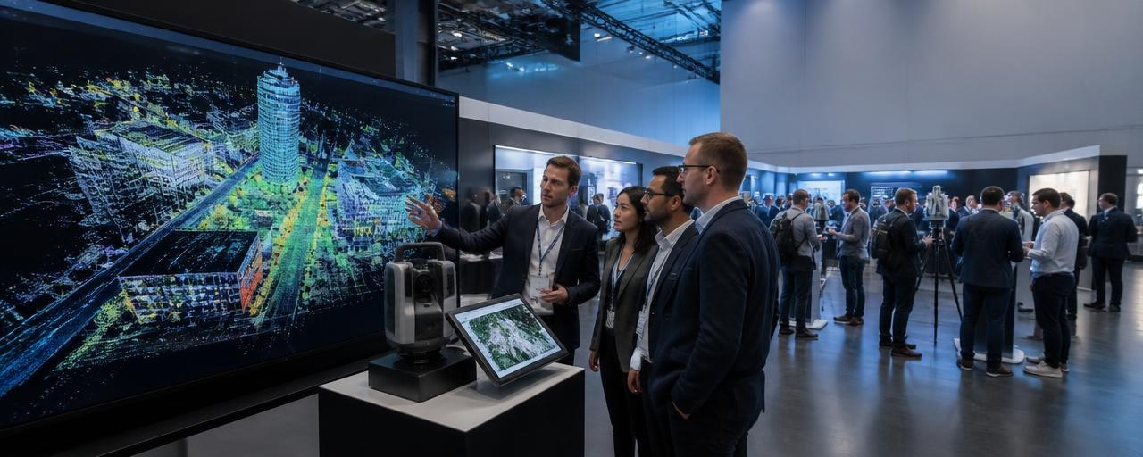
Frankfurt INTERGEO 2027: event overview
INTERGEO is the international trade fair and conference for geodesy, geoinformation and land management. The 2027 edition is scheduled for 12–14 October 2027 at Messe Frankfurt, Frankfurt, Germany. It combines an exhibition of geospatial solutions with a conference and expo-stage programme. The event connects technology providers with professional users in surveying, mapping, public administration, infrastructure, construction, urban development and related fields.
INTERGEO 2026 took place in Munich on 15–17 September. The organiser’s post-event report describes a programme spanning digital twins, GeoAI, remote sensing, earth observation, BIM and geodata infrastructures. Those 2026 sessions and demonstrations are useful examples of the event’s subject matter, not a confirmed programme for 2027.
Why Frankfurt INTERGEO matters
Discover geospatial tools in context
Geospatial work depends on a chain of connected capabilities: capturing accurate observations, processing and managing data, visualising it for different users, and applying it to decisions. INTERGEO’s stated scope—geodesy, geoinformation and land management—brings these professional areas together. Visitors can use the exhibition to examine the equipment, software and services relevant to their own part of that chain.
Compare approaches, not just product claims
Surveying and sensor manufacturers, GIS and data-platform providers, technology companies and institutions are among the exhibitor groups identified by the organiser. A visit can therefore be planned around concrete comparisons: how a system captures data, what formats and workflows it supports, how it fits with existing tools, and what evidence a supplier can provide for a real project.
Connect technology with public and commercial applications
The 2026 conference addressed digital twins for infrastructure, energy and municipal applications, and sessions on GeoAI, earth observation, BIM and modern geodata infrastructures. The organiser’s post-event report also links precise, usable geoinformation with urban development, infrastructure, mobility, the environment, construction and public administration. These examples show why geospatial tools matter beyond specialist mapping teams, while the 2027 programme remains to be confirmed.
- 2026 exhibitors: more than 530, according to the organiser; the same report says they came from 119 countries.
- 2023 visitors: Messe Frankfurt reported around 17,800 visitors, approximately 45 percent from outside Germany.
The figures refer to different editions and measures. They show the event’s international professional reach, but do not establish the number of visitors expected in 2027.
Who should visit Frankfurt INTERGEO?
Choose your priorities according to the work you need geospatial technology to perform. The following groups are supported by the organiser’s stated exhibitor and visitor positioning and by the documented 2026 programme.
Surveyors and geodesy professionals
Useful if you are evaluating ways to capture, verify or manage spatial measurements. Focus on survey instruments and sensors, data-capture workflows, accuracy evidence, field-to-office transfer and how tools work alongside your established equipment. Prepare a short list of representative site conditions and data outputs so supplier discussions stay tied to actual work rather than general demonstrations.
GIS, geodata and software teams
Useful if you develop, procure or operate GIS, geodata platforms, remote-sensing or reality-capture solutions. Compare how products ingest, process, manage and visualise spatial information; ask which formats, interfaces and deployment requirements are documented. The 2026 programme’s coverage of GeoAI, earth observation and geodata infrastructures offers useful context, but check the 2027 schedule when it is released.
Public administration, infrastructure and urban-planning professionals
Useful if your work involves municipal services, land management, transport, construction, environmental tasks or public geodata. The 2026 conference explicitly covered infrastructure, energy and municipal digital-twin applications, and the organiser described public administration among the communities attending. Bring one defined operational question—such as how spatial information supports an asset, planning or service workflow—and use demonstrations to identify what would need local evaluation.
Researchers and technical specialists
Useful if you work on geospatial methods, remote sensing, photogrammetry, BIM, digital twins or the application of AI to geoinformation. The 2026 report describes scientific contributions alongside business and administrative examples. Use the event to compare research methods with practical implementations and to identify where data quality, interoperability or validation questions need further investigation.
Geospatial technology exhibitors and start-ups
Useful if you supply surveying or sensor equipment, GIS or data platforms, software, geospatial services or emerging technologies. The organiser identifies technology providers, software companies, surveying and sensor manufacturers, GIS and data-platform providers, start-ups, institutions and organisations as relevant exhibitor groups. Define the particular application and user problem your team can demonstrate, and qualify any product claims with evidence.
What can you find at Frankfurt INTERGEO?
The event’s confirmed subject is geodesy, geoinformation and land management. The organiser’s 2027 exhibitor information specifically names technology and software companies, surveying and sensor manufacturers, GIS and data-platform providers, start-ups and institutions. The 2026 programme report supplies additional examples of topics and applications from the previous edition.
Surveying, geodesy and sensor technologies
- Surveying and measurement systems and related sensors.
- Methods and tools for collecting geospatial observations.
- Workflows for checking, transferring and using captured data.
GIS, geodata and information platforms
- GIS and geospatial data platforms.
- Geodata infrastructures and ways spatial information is managed and made usable.
- Data services and visualisation approaches relevant to professional users.
Remote sensing, photogrammetry and reality capture
- Remote-sensing and earth-observation applications, discussed in the 2026 programme.
- Photogrammetry and reality-capture workflows as part of the event’s geospatial remit.
- Methods for translating observations into data that can support analysis and operational work.
Digital twins, GeoAI and BIM applications
- Digital twins for infrastructure, energy and municipal applications featured in the 2026 conference.
- GeoAI sessions covering scientific foundations, remote-sensing applications and business use cases.
- BIM and modern geodata infrastructures included among the 2026 closing-day topics.
These programme examples are from 2026. They should guide your questions, not be treated as a promise that the same sessions, exhibitors or demonstrations will appear in 2027.
What makes Frankfurt INTERGEO distinctive?
It brings geospatial technology and its varied professional applications into one trade-fair and conference setting. The event is not limited to surveying equipment: its documented scope extends from geodesy and geoinformation to land management, while recent programme examples connect spatial data to infrastructure, energy, municipalities, urban development, mobility, construction and environmental work.
At the 2026 edition, the organiser reported more than 530 exhibitors from 119 countries. Its post-event account describes a combination of exhibition demonstrations and conference discussion, including GeoAI, digital twins, earth observation, BIM and geodata infrastructure. For visitors, that mix can make it possible to compare practical tools and broader approaches during one visit. The precise 2027 exhibitor list and programme should be checked when published; last year’s examples are not guarantees for the next edition.
What should you try to achieve at Frankfurt INTERGEO?
A useful visit starts with a decision you need to make. “See what is new” is too broad to guide a multi-day professional exhibition. Translate your work into a question, then choose the exhibitors and sessions that can help you investigate it.
If you are a buyer or technical evaluator
Example objective: shortlist three solutions for one defined data-capture or geospatial-platform requirement. Record the use case, required outputs, current systems, integration constraints and evidence needed for a fair comparison. Ask each supplier the same core questions and distinguish demonstrated capability from a feature that still needs testing.
If you work in public administration or infrastructure
Example objective: identify two workflows where better spatial information could support a defined service, asset or planning task. Compare how providers describe data provenance, update processes, interoperability, user roles and operational ownership. Note which requirements depend on your organisation’s own data, procurement rules or standards.
If you are a researcher or geospatial specialist
Example objective: identify one method, dataset or validation question to examine with both researchers and solution providers. Capture the method, assumptions, scale and limitations behind each relevant demonstration. Follow up on technical evidence rather than relying on a product’s visual presentation alone.
If you are exhibiting
Example objective: have focused technical conversations with a defined user group about one application your solution addresses. Prepare a concise demonstration, the data and conditions it requires, evidence of performance, and the next technical question to resolve. Treat interest as an invitation to qualify fit, not as a forecast of sales.
How to prepare before Frankfurt INTERGEO
1. Write a decision brief
Before planning your visit, write down the task you are trying to improve: measurement, data capture, GIS management, remote-sensing analysis, digital-twin development, municipal planning or another geospatial workflow. Add the scale of the task, data sources, outputs, existing systems and constraints. This will help you distinguish relevant products from demonstrations that are interesting but outside your remit.
2. Build a target list when the 2027 directory is available
The event site provides exhibitor-list information for the previous edition and describes an international exhibitor base. When the 2027 directory is published, shortlist companies by product category and application rather than trying to see every stand. The current 2026 list is a planning reference, not confirmation of 2027 participation.
3. Rank your conversations
- A — essential: suppliers or research teams directly related to your project or procurement decision.
- B — useful: alternative approaches, adjacent data platforms or potential integration partners.
- C — explore if time allows: emerging technologies and themes that may shape future work.
For each A-priority conversation, prepare a short context statement and the technical question that would make the meeting useful. Do not assume a meeting service or matchmaking tool is available unless the organiser confirms it for 2027.
4. Prepare geospatial-specific questions
- Which data-capture methods and sensor configurations does the solution support?
- What accuracy, resolution, coverage or validation evidence can the supplier provide for the intended use?
- How are coordinate reference systems, metadata, provenance and update cycles handled?
- Which file formats, APIs or documented interfaces support exchange with existing GIS, BIM or asset systems?
- What processing is performed locally, in a hosted service or in another environment?
- How does the workflow handle data quality, uncertainty, versioning and corrections?
- What data, equipment, connectivity and staff skills are required to reproduce the demonstration?
- Which parts of a digital-twin or GeoAI workflow are operational today, and which still require project-specific development?
- What security, privacy, licensing or public-sector requirements should a customer assess?
- What technical documentation, trial data or evaluation steps can be shared after the event?
5. Check confirmed practical details
The 2027 edition is scheduled at Messe Frankfurt. Check the organiser’s current visitor information for ticket terms, opening hours, access arrangements, programme updates and exhibitor details before making final plans. Do not rely on dates, hall layouts or schedules from an earlier edition.
How to make the most of the exhibition
Use a consistent record for each supplier or demonstration so that the information remains comparable after several conversations:
- Company or team: record the name and the relevant contact or department.
- Product or method: describe the sensor, platform, dataset or workflow discussed.
- Why it may fit: connect the feature to your defined surveying, GIS, planning, infrastructure or research need.
- Evidence to request: note accuracy information, validation, sample data, interface documentation or case-specific technical details.
- Next action: record a trial, technical review, internal discussion or follow-up question.
For a point-cloud or reality-capture demonstration, for example, note the capture conditions and processing steps as well as the final visualisation. For a GIS or digital-twin platform, record which data sources and interfaces were actually shown. Ask what would need to change before the same workflow could be used in your own environment.
Take short notes immediately after each conversation. Separate confirmed product information from an interpretation, a roadmap statement or a question that remains unanswered. This prevents a polished demonstration from being mistaken for verified performance in your project conditions.
Plan your time realistically
INTERGEO is scheduled across three days. The 2027 hall plan and programme should determine the final schedule, so avoid assuming that the previous edition’s layout or session timings will repeat. A flexible framework can still help you reserve time for the different kinds of work.
Before the visit
Choose a small number of priority themes and identify the official programme items and exhibitors that match them once those details are published. Leave space for unexpected demonstrations, but protect time for conversations tied to your main objective.
During each day
- Use an early block for priority supplier or research conversations while your technical questions are fresh.
- Reserve a separate block for conference or stage sessions that directly inform your project.
- Leave transition time between sessions and exhibition conversations; do not schedule every minute.
- At the end of the day, review notes and mark each item as follow-up, further research or not relevant.
At the end of the event
Use the final block for unresolved priority questions and for checking whether you have enough evidence to make a next-step decision. A complete contact list is less useful than a short list of validated technical leads and clearly defined follow-up actions.
Beyond the exhibition floor
INTERGEO combines the expo with a conference and stage programme. For context, the official report on the 2026 edition records digital-twin sessions addressing infrastructure, energy and municipal applications; a conference day focused on GeoAI, including remote-sensing applications and business use cases; and closing topics that included earth observation, BIM and modern geodata infrastructures. It also describes programming on the MAIN Stage and APPLICATION Dome.
These are examples from the previous edition only. When the organiser publishes the 2027 schedule, compare session descriptions with your objectives. Prioritise a session when it can answer a question that product demonstrations alone cannot—for example, how a method is validated, what assumptions underpin a workflow or how geospatial information is used in an administrative or infrastructure context.
Networking at Frankfurt INTERGEO
Make technical conversations easy to continue after the fair. Prepare a brief introduction that explains your role, the data or operational challenge you are working on, and the kind of information you need. For a supplier discussion, state whether you are evaluating sensors, data capture, GIS, remote sensing, geodata management or an application such as a digital twin.
When a conversation is relevant, agree on a specific next step: a technical document, a sample dataset, a demonstration using representative conditions or a discussion with the colleague responsible for integration or procurement. Record who owns that action and when you will review it. The event can create opportunities for discussion, but it cannot guarantee access to a decision-maker, a partnership or a commercial result.
Travelling to Frankfurt INTERGEO
The confirmed venue for the 2027 edition is Messe Frankfurt in Frankfurt. Check the organiser’s current arrival information and the venue’s visitor guidance before travelling, because the previous edition was held in Munich and its access details do not apply automatically to Frankfurt. Confirm the current entrance, transport options, registration requirements and any event-specific arrangements directly with the organiser closer to the dates.
One day or several days at Frankfurt INTERGEO?
The event runs for three days. The right length of visit depends on whether you need an exhibition-only comparison, a mix of expo and conference, or time for several distinct professional objectives.
One day
- May suit a visitor with one tightly defined product category or a short list of priority suppliers.
- Choose the most relevant sessions and demonstrations in advance once the programme is confirmed.
- Allow time to compare evidence and record follow-up actions rather than attempting to cover every topic.
Two days
- May suit teams comparing several technology categories or combining supplier conversations with conference sessions.
- Separate the main application areas—for example, surveying and data capture on one day, GIS or geospatial applications on another—according to the final exhibitor and programme information.
- Review notes between days so the second day can address gaps rather than repeat the same broad browsing.
Three days
- May be useful for visitors with several project areas, multiple colleagues or a need to combine technical evaluation with conference participation.
- Use the extra time to follow up on questions raised earlier, not simply to add more unprioritised stands.
- Recheck the official 2027 schedule and hall information before assigning each day a focus.
Bring a project to Frankfurt INTERGEO
If you are evaluating a system or planning a geospatial project, prepare a short, non-confidential project brief. Include the application, area or asset type, data already available, required output, expected update cycle, existing software or equipment, and the people who will use the result. For survey and reality-capture work, note the conditions that affect measurement and validation. For GIS, BIM or digital-twin work, list the data interfaces, coordinate reference requirements, user roles and operational constraints that matter to your team.
Do not share sensitive location data, security details or protected project information casually at a public exhibition. Use representative or anonymised material for an initial discussion, and agree on an appropriate channel for any detailed technical exchange.
After Frankfurt INTERGEO: turn notes into decisions
Within a few days, sort your contacts into three groups:
- A — immediate evaluation: a supplier or method appears relevant to an active project and you have a defined technical question to resolve.
- B — potential fit: the solution may be useful, but you need additional evidence, an internal owner or a clearer use case.
- C — market or research intelligence: the conversation informs future planning but does not justify an immediate purchase or project step.
For each A contact, send a concise follow-up that restates the application discussed and requests the evidence or action agreed at the stand. Compare suppliers against the same requirements: data quality, compatibility, validation, deployment conditions, support and total project fit. For conference insights, record the source and the question they raise for your own team. Treat conversations as inputs to evaluation, not as proof that a product is suitable or that a partnership will result.
Who should consider exhibiting at Frankfurt INTERGEO?
The organiser’s 2027 exhibitor information identifies technology providers and software companies, surveying and sensor manufacturers, GIS and data-platform providers, start-ups, institutions and organisations. The 2026 edition’s reported international exhibitor base indicates that the event serves a broad professional audience, but does not guarantee that a specific target customer will attend.
Exhibitors should define the application and audience they want to address before selecting a demonstration. A useful stand conversation can make clear what the solution does, what input data and conditions it requires, which standards or interfaces it supports, what performance evidence exists, and what further test would establish fit. For early-stage products, distinguish available capability from planned development. Set measurable objectives such as qualified technical discussions or feedback on a defined use case, then review whether each conversation produced the evidence needed for a next step.
Frankfurt INTERGEO visitor checklist
Before
- ☐ Define the geospatial task or decision you want the event to support.
- ☐ Check the 2027 exhibitor directory and programme when the organiser publishes them.
- ☐ Rank priority exhibitors and sessions; prepare questions on data quality, interfaces and validation.
- ☐ Confirm current ticket, venue-arrival and access details with the organiser.
- ☐ Prepare a concise, non-confidential project brief and the requirements you can share.
During
- ☐ Compare products against the same use case and record what was demonstrated versus what remains unverified.
- ☐ Note data inputs, formats, accuracy evidence, integration needs and operating conditions.
- ☐ Connect relevant conference topics to your own research, public-sector or infrastructure questions.
- ☐ Agree a specific follow-up action when a conversation merits further evaluation.
After
- ☐ Sort contacts by urgency and project fit.
- ☐ Request the technical evidence or next step discussed.
- ☐ Review solutions against your organisation’s data, standards, security and procurement requirements.
- ☐ Share findings with the colleagues who own the relevant operational or purchasing decision.
Is Frankfurt INTERGEO worth visiting?
Frankfurt INTERGEO is most relevant to professionals who work with surveying, geoinformation, land management, geospatial platforms or the applications that depend on spatial data. The exhibition can support supplier discovery and technology comparison; the conference and stages add a place to examine broader methods and use cases. Public administration, infrastructure, urban-planning and research teams may find value where their work depends on accurate, usable geodata.
The event is less useful as an unstructured walk through technology displays. Prepare a specific task, ask suppliers comparable technical questions and follow up on evidence after the event. The 2027 exhibitor and programme details should be checked when available; the 2026 examples provide context, not a guarantee of next year’s content.
Frankfurt INTERGEO 2027 at a glance
| Item | Information |
|---|
| Event | INTERGEO |
| Dates | 12–14 October 2027 |
| City | Frankfurt, Germany |
| Venue | Messe Frankfurt |
| Subject | Geodesy, geoinformation and land management |
| Format | Trade fair and conference, with expo-stage programming |
| Organizer | Hinte Expo & Conference GmbH remains the organising partner through 2027; DVW e.V. sponsors INTERGEO |
| Latest exhibitor figure found | More than 530 exhibitors from 119 countries, reported for 2026 by the organiser |
| Latest visitor figure found | Around 17,800 visitors in 2023, reported by Messe Frankfurt; around 45 percent came from outside Germany |
| 2027 programme and directory | Detailed 2027 programme and exhibitor list are not confirmed in the 2027-specific information reviewed |
Dates and venue are confirmed on the official event pages. The scale figures refer to prior editions, and the detailed 2027 programme and exhibitor list should be checked when the organiser publishes them.
Plan your Frankfurt INTERGEO visit around a decision
Before you go, ask: Which geospatial decision, technical comparison or professional question do I want to move forward? Use the exhibition to discover and compare, the programme to explore methods and applications, and follow-up to verify technical fit. Define the question, collect evidence, and choose the next step.
Capture. Compare. Validate. Apply.
Geospatial technology opportunities in Germany
Public geodata infrastructure and market context
Germany’s Geodata Access Act (GeoZG) establishes official cadastral, geotopographic and geodetic reference data as core components of the national geodata infrastructure. The law assigns provision responsibilities to the competent federal and state bodies and sets out requirements concerning geodata and geodata services. This is a concrete institutional framework for geospatial data, not a quantified estimate of Germany’s commercial market size or proof of demand for any particular product.
Potential areas to investigate
For providers of GIS platforms, surveying systems, geodata services and data-management tools, one possible line of investigation is how their products exchange, document and use authoritative spatial information in workflows involving public bodies. The 2026 INTERGEO programme also addressed digital twins for infrastructure, energy and municipalities, alongside GeoAI, earth observation and modern geodata infrastructures. These topics suggest application areas that exhibitors and visitors could explore, but the programme does not establish procurement demand or a supplier gap.
- Interoperable geospatial services: suppliers may assess whether their interfaces, metadata and data-management approach fit relevant public-sector workflows; requirements depend on the specific data and customer.
- Surveying and reference data: equipment and software providers could examine how captured measurements connect with authoritative reference information and downstream GIS use.
- Digital-twin and infrastructure applications: technical teams may investigate how geospatial data supports a defined asset, municipal or energy use case, while validating data quality and operational needs independently.
Regulatory and market-entry conditions
The Geodata Access Act is in force and applies to the relevant public geodata-holding bodies and geodata services within its scope. Its provisions cover the national geodata infrastructure, data provision, metadata and interoperability. A supplier should assess the law and any applicable standards or customer requirements for the specific product and use case; the Act does not by itself establish a commercial entitlement, contract or customer access.
What this could mean for exhibitors
Exhibitors may use INTERGEO to test how clearly they can explain interoperability, metadata, data provenance and integration into public or infrastructure workflows. Discussions can help identify technical questions to investigate, but neither the event nor the legal framework guarantees access to public buyers or commercial opportunities.
What this could mean for visitors
Visitors may compare tools for capturing, managing and applying spatial information against a real municipal, land-management or infrastructure requirement. They can use the law as a prompt to check data responsibilities and service expectations, then verify technical, licensing and procurement conditions with the relevant organisation.
See the ilikevents services for this event
For further information, please click
here .